Background Image
March - April 2025
Icon representing 107 Passes 107 Passes
Icon representing 588.6 km 588.6 km
Icon representing an elevation of 60,173m 60,173m
Icon representing 40 Days 40 Days
Read more about it...

About the Expedition

Michaela Geytenbeek and Arno Pouwels are attempting something pretty unfathomable that will push the boundaries of human endurance and adventure. They will undertake an extreme version of the Drakensberg Grand Traverse (DGT), completing all the marked Drakensberg passes along the way and summiting the six iconic peaks that form part of the DGT. This audacious endeavor, which has never been attempted before, involves completing 107 passes, hiking 588 km, and conquering 60,173 meters of elevation gain, equivalent to climbing seven Everests, all within 40 days (weather permitting).

To grasp the scale of this undertaking, consider this: there are only four known individuals* who have completed over 100 Drakensberg passes – Clem Robins, Tony Marshall, Andrew Porter, and Jonathan Newman. It took them several years to achieve this monumental task. In an unparalleled bid, Michaela and Arno aim to accomplish this feat in just 40 days.

The Drakensberg passes vary dramatically in condition: from smooth, clear smuggling paths, to boulder-strewn gullies, steep pathless banks, and wildly overgrown corners. Additionally, these mountains are known for their unpredictable weather, which can include scorching heat, sudden severe thunderstorms, hail, lightning, and even snow. Michaela and Arno will face all of these challenges head-on.

*Extensive research and effort has gone into determening these four individuals. Please reach out to us if you know of anyone else.
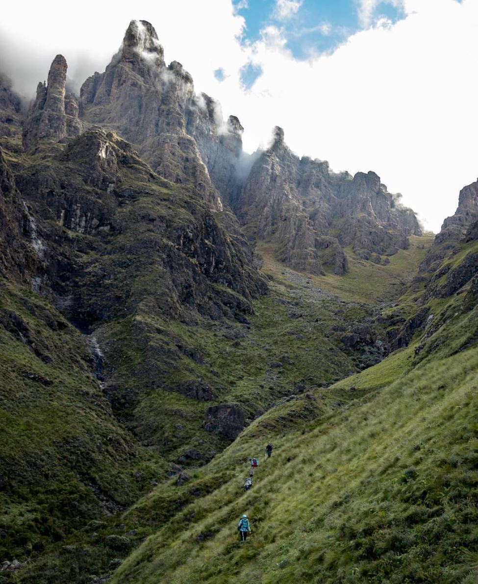
Majestic Drakensberg Mountains
Tseketseke Pass

Who We Are

Portrait of Michaela Geytenbeek

Michaela "Mix" Geytenbeek

Michaela is a sustainability education consultant with a keen interest in education for the earth and holistic child development. She is a qualified mechanical engineer, pre-primary and elementary Montessori teacher, off-trail mountain guide and a keen trail runner. She founded the Kinship Programme and completed an MPhil in Sustainable Development. Michaela is dedicated to fostering nature connectedness and has co-founded a Montessori school, designed environmental education curricula, and particularly enjoys working in underserved communities.

Mountain Experience: Michaela, a qualified mountain guide, has led a variety of trips in the Drakensberg - spanning from very leisurely trips along the Giant’s Cup to single day missions of difficult passes, sharing her love for the mountains with others through PathFinders_SA.

Notable Hikes: Kilimanjaro (2014), Annapurna Circuit (2019), Amatola Trail (2020), Alta Via 2 (2021), Wild Coast Hike (2023), Drakensberg Grand Traverse - Unsupported in 4.5 days (2024).

Follow Michaela: Instagram Strava

Portrait of Arno Pouwels

Arno Pouwels

Arno is a SAP Technical Consultant working in the IT industry, where he combines his technical skills with his love for problem-solving. He is an avid trail runner, photographer, and hiker who finds joy in the simplicity of nature. Passionate about traveling on foot, Arno has completed thru-hikes on the Pacific Crest Trail and the Arizona Trail, embracing a minimalist approach to travel. He thrives on the challenges and adventures that the outdoors offer, always seeking new trails to conquer. The mountains are his happy place, providing a peaceful retreat from the demands of everyday life.

Mountain Experience: Arno has completed thru-hiking trips spanning multiple months. He has led various hikes in the Drakensberg, sharing his love for the mountains with others. Arno enjoys taking people who have never been to the mountains, guiding them to experience the beauty and tranquility of these natural landscapes.

Notable Hikes: Kilimanjaro (2019), Pacific Crest Trail (2022), Drakensberg Grand Traverse (2023), Arizona Trail (2024), Drakensberg Grand Traverse - Unsupported in 4.5 days (2024)

Follow Arno: Instagram YouTube Strava

Why We Are Doing It

Early Childhood Development Program
The CEEE project

A journey to reconnect with the earth and raise awareness about the importance of education for earth stewardship and sustainable futures. Woven into the story will be lessons of nature’s gifts to humanity, the undulating path of life, the power of mental fortitude and the great capabilities of humans.

There is great purpose driving this expedition. While sharing the mountain’s story they will be raising funds for a project called, Community Embedded Environmental Education: which aims to enthuse and empower underserved Early Childhood Development (ECD) teachers to incorporate environmental education and nature in the daily practice of their ECD Centres.

Learn more about the CEEE project.

Support Our Expedition

We acknowledge that we cannot achieve this alone. That would be lunacy. There will be days when taking another step seems too complicated, when routes may evade us, and when our skill set may not be adequate for the task at hand. Here's how you can help:

  • Donate: Use our BackaBuddy page to contribute towards the expedition and our cause.
  • Follow: Follow along on our Instagram page for expedition updates.
  • Share Our Story: Spread the word about our expedition and the significance of environmental education by sharing our story on your social media platforms.
  • Supportive Messages: We'd love to hear from you! Send your supportive messages to [email protected].
  • Join Our Team: Become a part of our support crew and provide assistance in any form along this journey.

Every bit of support, whether big or small, will make a significant difference.

Sunrise from Rolands Cave

Our Route

Use the navigation bar to view the route for a specific day.

  • Walking Home
  • Day 1
  • Day 2
  • Day 3
  • Day 4
  • Day 5
  • Day 6
  • Day 7
  • Day 8
  • Day 9
  • Day 10
  • Day 11
  • Day 12
  • Day 13
  • Day 14
  • Day 15
  • Day 16
  • Day 17
  • Day 18
  • Day 19
  • Day 20
  • Day 21
  • Day 22
  • Day 23
  • Day 24
  • Day 25
  • Day 26
  • Day 27
  • Day 28
  • Day 29
  • Day 30
  • Day 31
  • Day 32
  • Day 33
  • Day 34
  • Day 35
  • Day 36
  • Day 37
  • Day 38
  • Day 39

See the route on Gaia GPS for more statistics.

Download our full route in PDF format here to see the planned passes per day, campsites, and notes.

Live Tracking

Use the Garmin Explore map below to track our progress live.

*This will only become active once we enable our Garmin Inreach device in March 2025.

Our Sponsors

We are incredibly grateful for the generous support of our sponsors. Their commitment helps us make a significant impact and drive our mission forward. Thank you for believing in us and joining us on this journey.

Salomon Logo